Blog · All posts · The Neighbourhood
How Walkable Is Port Perry? A Local Guide to the Streets Around 459 Victoria
2026-09-18 · The Neighbourhood · By Keith Williams & Lisa C. Follows

Key takeaways
- Port Perry is a compact, traditionally walkable town: from the residential streets around 459 Victoria Street, Queen Street and the Lake Scugog waterfront are about a 10 to 20 minute walk.
- The heritage core is a Walker’s Paradise on Walk Score (150 Bigelow St. scores 92/100), while the town’s outer roads quickly become car dependent, so exact location matters.
- Queen Street runs from Simcoe Street to Water Street, where it opens straight onto the lake at Palmer Park, with a roughly 5 km waterfront trail system along Lake Scugog.
- There is no GO station in Port Perry; the standard commute is a Durham Region Transit route 905 bus to Whitby GO, then the Lakeshore East train into Union Station.
- Walkability is not just a pleasant extra here. It shapes everyday life, from the school run to the morning coffee and the summer evening walk along the water.
How walkable is Port Perry, Ontario? Port Perry is a compact, traditionally walkable small town, and from the residential streets around 459 Victoria you can walk to Queen Street, the cafés and the Lake Scugog waterfront in about 10 to 20 minutes. Walk Scores tell the same story: the heritage core around Queen Street and Water Street ranks as a “Walker’s Paradise” at 92/100, while the town’s outer roads quickly become car dependent.
That short answer matters more than it sounds. In many GTA towns you drive to everything, and the car shapes the day. In Port Perry, the scale is human. A morning coffee, a school drop-off, a weekend errand and an evening walk by the water can all happen on foot from the right street. This guide explains what walkability actually means here, street by street, so you can judge whether a home like 459 Victoria fits the way you want to live.
How walkable is Port Perry, really?
Port Perry has no single town-wide Walk Score, and that is the honest first fact: walkability here changes block by block. The town of about 9,553 residents (2021 census) has a walkable Victorian core and spread-out residential edges, so your experience depends almost entirely on which street you live on.
The data confirms it. Walk Score rates 150 Bigelow Street at 92 out of 100, a “Walker’s Paradise” where daily errands do not require a car. Mid-town streets sit in the “Somewhat Walkable” band, with 524 Alma Street at 59, and the town’s outer residential roads drop into car-dependent territory, with streets like 14375 Simcoe Street at 26 and 1910 Scugog Street at 16. The lesson for buyers is simple: a few hundred metres can be the difference between walking to town and driving to it.
The neighbourhood around 459 Victoria falls on the walkable side of that line. It sits inside the town core’s reach, close enough that the main street, the waterfront and the trail are a reasonable stroll, while the back fence opens onto its own green space. That combination, a town you can walk and a private natural yard, is exactly what the green space behind the fence is about.
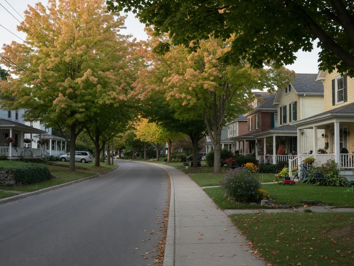
The walk from 459 Victoria Street
Let us be specific about this street, because that is what a walkability question really wants. From 459 Victoria, Queen Street and the Lake Scugog waterfront are roughly a 10 to 20 minute walk, a pace that is comfortable with a stroller, a shopping bag or a dog on a leash. The route passes calm residential streets with sidewalks, so it works year-round, including the school run.
For families, the practical question is the school walk. The local elementary options are all within a short drive or an easy ride from this part of town, and our family guide to Port Perry schools walks through R.H. Cornish, S.A. Cawker, Good Shepherd and Port Perry High. Walkability and schooling are two sides of the same daily rhythm: both decide how much of your morning is spent in the car.
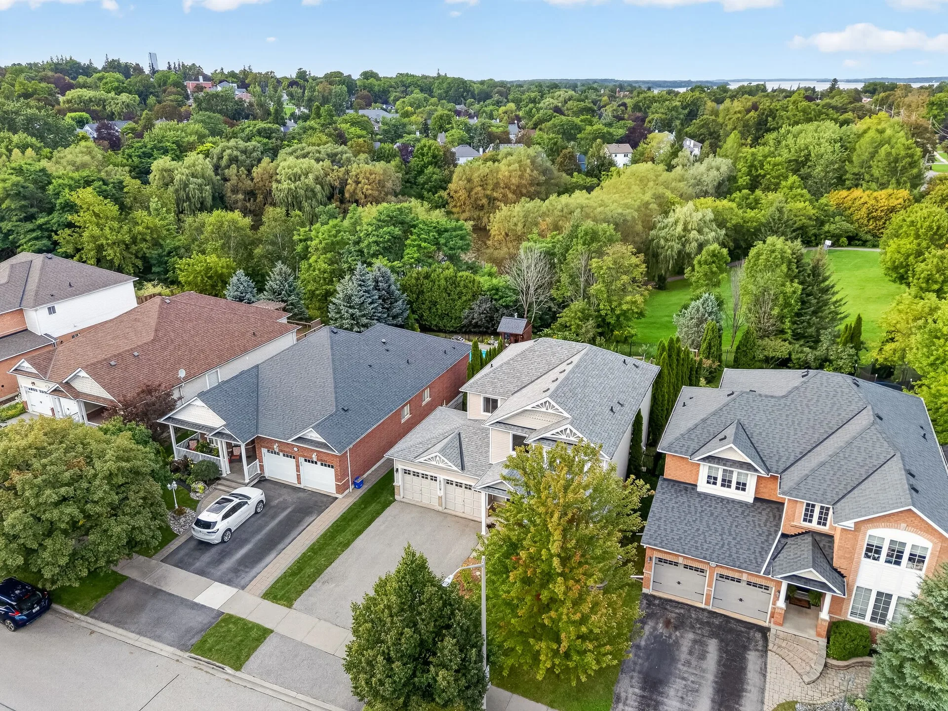
The drone view of the neighbourhood, shown above, makes the layout obvious. The home sits on a residential loop with green space at its edge, and the compact town core is close by. That is the layout that makes a walkable lifestyle feel effortless rather than a stretch.
Queen Street: the walkable heart
Port Perry’s walkability is built around Queen Street, the restored main street and the heart of the designated Heritage Conservation District. Queen Street runs from Simcoe Street to Water Street, lined with boutique shops, antique stores, cafés, galleries and restaurants, and it opens directly onto the Lake Scugog waterfront at Palmer Park. It is a street made to be walked, not driven.
That is where the daily errands land. A morning coffee at a place like That Place on Queen or Nexus Coffee Co., a browse through Port Perry’s Vintage Market in the old train-station building, a gift from Meta4 Contemporary Craft Gallery, a long dinner at the Piano Cafe and George Stanley Inn in its restored 1884 landmark. All of it is on one walkable main street, a short stroll from the residential streets behind it.
The design of the town leans into this. The waterfront trail system, roughly 5 km of lakeside paths maintained by the township, connects the core to the lake and the parks, and the marina is about a 12 minute walk from many waterfront properties. For a fuller sense of the daily rhythm here, see our guide to life in Port Perry, which covers the town’s lake rhythms and its main-street pull.
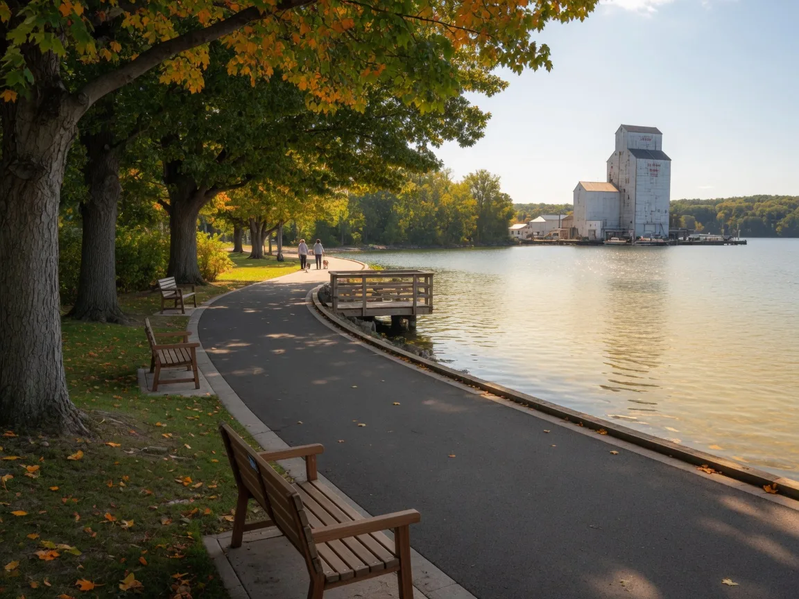
The waterfront and the 5 km trail
The second half of Port Perry’s walkability is the water. The Township of Scugog’s trail network runs about 5 km along Lake Scugog, with lookouts, benches and open water. Palmer Park at 175 Water Street and Kinsman Beach are the classic destinations, with a splash pad, playground and the best lake views in town. On a warm evening, the trail fills with people walking dogs, pushing strollers and slowing down.
For the home at 459 Victoria, this is a quiet bonus. The lot backs onto its own green space with mature trees, a walking trail and a pond, so the walkable town and the natural edge meet right at the back fence. You get the best of both: a town you can walk and a private yard you never have to leave for green.
Getting to Toronto when you need to
Walkability does not replace the commute, so let us be straight about it. There is no GO station in Port Perry. The standard route to downtown Toronto is a Durham Region Transit route 905 bus from the Port Perry terminal to Whitby GO, then the GO Train Lakeshore East line into Union Station, roughly 1¼ to 2½ hours door to door. By car, downtown Toronto is about 74 km and roughly 1 hour 15 minutes via Highway 7/12 to the 401.
What that means in practice: many residents drive to a GTA job and come home to a quieter, walkable town. The car gets you to work; the walk gets you everything else. The 2026 Port Perry market guide looks at what that trade-off is worth in today’s prices.
Who is Port Perry walkability for?
Walkability here suits a particular kind of buyer. It suits families who want to walk the kids to the playground or the trail, and couples who like an evening stroll to dinner and back without touching the car keys. It suits people moving from a city who are not ready to give up the feel of a main street, and retirees who want shops and water within reach.
It is less important if your week is built around long drives anyway. The honest advice we give every buyer is to visit the exact street at the exact time of day you would use it, walk the route to the school and the coffee shop, and time it. Our Port Perry neighbourhood guide maps the schools, commutes and local businesses around 459 Victoria so you can plan that walk before you make an offer. And if you want to feel the town on foot before you buy, talk to us and we will walk it with you.
Walkability in Port Perry, asked plainly
How walkable is Port Perry, Ontario?
Port Perry is a compact, traditionally walkable small town. From the residential streets around 459 Victoria, Queen Street and the Lake Scugog waterfront are about a 10 to 20 minute walk. Walkability varies by street: the heritage core is a Walker’s Paradise (150 Bigelow Street scores 92/100 on Walk Score), while outer roads are car dependent.
How far is it from 459 Victoria to downtown Port Perry?
From 459 Victoria Street, Queen Street and the Lake Scugog waterfront are roughly a 10 to 20 minute walk along calm residential streets with sidewalks. Queen Street runs from Simcoe Street to Water Street, where it opens onto the lake at Palmer Park.
Is there a waterfront walking trail in Port Perry?
Yes. The Township of Scugog maintains a waterfront trail system of about 5 km along Lake Scugog, with lookouts and benches, connecting Palmer Park at 175 Water Street, Kinsman Beach and the town core. It is the town’s most popular walking route.
How do Port Perry residents get to Toronto?
There is no GO station in Port Perry. The usual route is a Durham Region Transit route 905 bus to Whitby GO, then the GO Train Lakeshore East line into Union Station, about 1¼ to 2½ hours door to door. By car, downtown Toronto is roughly 74 km and about 1 hour 15 minutes via Highway 7/12 to the 401.
Which streets in Port Perry are most walkable?
The most walkable streets are in and near the heritage core around Queen Street and Water Street. Walk Score gives 150 Bigelow Street a 92 out of 100 (Walker’s Paradise), while mid-town streets like 524 Alma Street sit around 59 and the outer roads drop into car-dependent territory, so the exact street matters a lot.
Written by your local team
Keith Williams & Lisa C. Follows are licensed Brokers and co-founders of Willows Realty Group, and the local experts and curators of this information. They know the streets of Port Perry and Scugog on foot, and they build each week’s guide around the questions real buyers actually ask. More about the team is on the About page.
More about the teamCall today to talk about your next move!
Call Lisa or Keith at 905-985-9898.